Checked
About Toronto, Ontario: a newcomer’s guide to Canada’s largest city
Toronto, Ontario, Canada
What to know about Toronto, Ontario: where it is, its 2021 population, the former cities that make up the megacity, how people get around, the economy, weather, hospitals, schools and landmarks.
Key information
Toronto is Ontario’s capital and Canada’s largest city, on the northwest shore of Lake Ontario, with 2,794,356 people in the 2021 Census. It is a city of neighbourhoods built from six former municipalities, run on the TTC, banking and a huge mix of languages, with cold snowy winters and warm humid summers.
On this page
Toronto at a glance
| Topic | Toronto |
|---|---|
| Province and role | Ontario. Toronto is the provincial capital. |
| Where | Northwest shore of Lake Ontario, 43 km east to west and 21 km north to south at its widest |
| Population (2021 Census) | 2,794,356, up 2.3% from 2,731,571 in 2016 |
| Latest City population figure | 3,025,647 (July 2022 estimate on the City’s Toronto at a Glance page) |
| Land area | About 630 square kilometres |
| Wards and neighbourhoods | 25 wards, 4 community council areas and 158 official neighbourhoods |
| Most common home languages after English | Mandarin, Cantonese, Tagalog, Spanish and Tamil |
| Average temperature | January -3.7°C, July 22.3°C (1981 to 2010 normals, downtown station) |
| Parks | More than 1,600 named parks and over 200 km of trails |
Sources: Toronto at a Glance | City of Toronto · 2021 Census: Population and Dwelling Counts backgrounder | City of Toronto · 2021 Census: Language backgrounder | City of Toronto · Community Council Area Profiles | City of Toronto · Neighbourhood Profiles | City of Toronto · Canadian Climate Normals 1981 to 2010, Toronto station | Environment and Climate Change Canada
Where is Toronto and what is around it?
Toronto sits on a broad plateau that slopes down to the northwest shore of Lake Ontario, about 76.5 metres above sea level at the waterfront. River valleys cut through it from north to south, which is why the city has so many ravines. The City counts 307 km of rivers and creeks, and every one of them drains into Lake Ontario.
The city stretches from the Etobicoke side, where it meets Mississauga at the lake, to the Rouge River in the east, and north to Steeles Avenue. Its highest point is the corner of Steeles Avenue West and Keele Street, at 209 metres. Toronto is the centre of the Greater Toronto and Hamilton Area, which had 7,281,694 people in 2021. The city itself holds 38.4% of them.
The Toronto Islands, a chain of small islands just off downtown, are part of the city and are reached by ferry. Rouge National Urban Park, Canada’s first national urban park, protects more than 79 square kilometres of forest, wetland and farmland on the city’s eastern edge.
Sources: Toronto at a Glance | City of Toronto · 2021 Census: Population and Dwelling Counts backgrounder | City of Toronto · Canada’s first national urban park turns 10 | Parks Canada
How many people live in Toronto, and who are they?
The 2021 Census counted 2,794,356 people in the City of Toronto, about 7.6% of everyone in Canada. That was 62,785 more people than in 2016, a 2.3% increase. Growth was strongest downtown: Toronto’s downtown core gained 16.1% and, at 275,931 people, was the most populated downtown in Canada.
Census counts miss some people, so Statistics Canada also publishes adjusted estimates. The City’s Toronto at a Glance page shows an estimate of 3,025,647 people for July 2022. Treat that as a separate, adjusted figure, not a census count.
Toronto is one of the most diverse places in the country. In the 2021 Census, 1,286,140 Toronto residents, or 46.6% of people living in private households, were immigrants. The median age was 39.6. In the city, 42.5% of residents had a mother tongue other than English or French, and 44.9% spoke at least one non-official language at home. Mandarin, Cantonese, Tagalog, Spanish and Tamil were the top non-English home languages. About 4.5% of residents could not hold a conversation in English or French.
Sources: 2021 Census: Population and Dwelling Counts backgrounder | City of Toronto · Toronto at a Glance | City of Toronto · Census Profile, 2021 Census: Toronto, City | Statistics Canada · 2021 Census: Language backgrounder | City of Toronto
What are the main areas and neighbourhoods of Toronto?
| Community council area | Includes the former | Wards |
|---|---|---|
| Etobicoke York | City of Etobicoke and City of York | 1, 2, 3, 5 and 7 |
| North York | City of North York | 6, 8, 15, 16, 17 and 18 |
| Toronto and East York | Old City of Toronto and Borough of East York | 4, 9, 10, 11, 12, 13, 14 and 19 |
| Scarborough | City of Scarborough | 20 to 25 |
Today’s Toronto was created on January 1, 1998, when six municipalities were merged: the old City of Toronto, York, East York, North York, Scarborough and Etobicoke. Locals still use those names every day, so “I live in Scarborough” means a part of Toronto, not a separate city.
For local decisions, City Council splits the city into four community council areas: Etobicoke York, North York, Toronto and East York, and Scarborough. There are 25 wards, each with one councillor. For planning and statistics, the City divides Toronto into 158 neighbourhoods, which replaced an older map of 140.
Beyond downtown, the City’s Official Plan names four Centres where jobs, homes and transit are concentrated: Scarborough Centre, North York Centre, Etobicoke Centre and Yonge-Eglinton.
Sources: Toronto | The Canadian Encyclopedia · Community Council Area Profiles | City of Toronto · Neighbourhood Profiles | City of Toronto · 2021 Census: Language backgrounder | City of Toronto
How do people get around Toronto?
The Toronto Transit Commission (TTC) runs the subway, streetcars, buses and light rail. An adult fare is $3.30 with PRESTO or a tap of a debit or credit card. Canada’s first subway opened under Yonge Street on March 30, 1954. The Canadian Encyclopedia describes the TTC as the largest transit system in Ontario and the third largest in North America.
GO Transit trains and buses, run by the provincial agency Metrolinx, connect Toronto with the surrounding region, mostly through Union Station. Drivers use Highway 401, the Gardiner Expressway, the Don Valley Parkway and the Queen Elizabeth Way, and traffic is heavy. Toronto Pearson is Canada’s busiest airport, and Billy Bishop Toronto City Airport on the Toronto Islands handles short flights.
Downtown, the PATH lets people walk more than 30 km underground and indoors, linking more than 75 buildings, six subway stations and Union Station. It is a lifesaver in January.
Sources: Canada’s First Subway Opens | City of Toronto web exhibit · Toronto | The Canadian Encyclopedia · PATH: Toronto’s Downtown Pedestrian Walkway | City of Toronto
What is Toronto’s economy like, and who are the big employers?
Toronto has a mixed economy, not a one-industry town. The Canadian Encyclopedia lists financial services, real estate, and wholesale and retail trade as the three largest industries. CIBC, Scotiabank and TD have head offices here, and the Toronto Stock Exchange is one of the leading exchanges in North America outside New York.
The City’s own indicators show about 96,351 business locations with employees and a labour force of 1,631,000 people in 2022, when unemployment was 6.8%. Toronto’s gross domestic product was about $171 billion in 2021, measured in 2012 dollars. Large hospitals and universities, film and television, tech, tourism and all three levels of government are also major employers.
Sources: Toronto | The Canadian Encyclopedia · Toronto at a Glance | City of Toronto
What is the weather like in Toronto?
| Measure | January | July | Year |
|---|---|---|---|
| Average daily high | -0.7°C | 26.6°C | 12.9°C |
| Average daily low | -6.7°C | 18.0°C | 5.9°C |
| Average temperature | -3.7°C | 22.3°C | 9.4°C |
| Snowfall | 37 cm | 0 cm | 122 cm |
| Total precipitation (rain and melted snow) | 62 mm | 64 mm | 831 mm |
Toronto has four clear seasons. Winters are cold and grey, with snow most years, while summers are warm and often humid. Lake Ontario softens the extremes a little near the shore.
These numbers are long-term averages from Environment and Climate Change Canada for the downtown Toronto station at the University of Toronto, for 1981 to 2010. Newer 1991 to 2020 normals were not available for this station when we checked.
Sources: Canadian Climate Normals 1981 to 2010, Toronto station | Environment and Climate Change Canada
Hospitals, universities and colleges in Toronto
Toronto is a major hospital city. University Health Network runs Toronto General, Toronto Western, Princess Margaret Cancer Centre and Toronto Rehab, and describes itself as one of the largest research and teaching hospital networks in Canada. The Hospital for Sick Children (SickKids) calls itself Canada’s largest paediatric academic health sciences centre. Toronto General is where insulin was first given to a patient, in January 1922.
The city’s universities include the University of Toronto (founded 1827), Toronto Metropolitan University (1948), York University (1959) and OCAD University. Public colleges with Toronto campuses include Centennial, George Brown, Humber and Seneca. Children attend schools run by four public boards: the Toronto District School Board, the Toronto Catholic District School Board and two French-language boards.
- Finding a family doctor and walk-in care in Toronto
- Registering for school in Toronto
- Library cards and borrowing in Toronto
Sources: About UHN | University Health Network · About SickKids | The Hospital for Sick Children · The Discovery of Insulin | The Canadian Encyclopedia · Toronto | The Canadian Encyclopedia · Ontario’s public colleges | Ontario Colleges
What is Toronto known for?
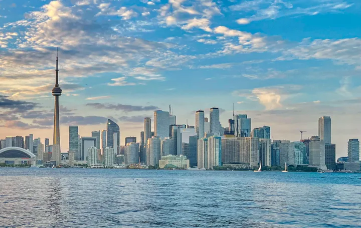
Most people picture the CN Tower first. At 553 metres it was the world’s tallest freestanding structure from 1975 until Dubai’s Burj Khalifa passed it. Close behind come the curved towers of City Hall and Nathan Phillips Square, the ferries to the Toronto Islands, Casa Loma, the Royal Ontario Museum, the Art Gallery of Ontario, Union Station and the St. Lawrence Market area.
Toronto is also known for its film festival (TIFF, first held in 1976), the Toronto Caribbean Carnival (first held in 1967 as Caribana), the Canadian National Exhibition, ravine trails and High Park. It has teams in every major league, including the Maple Leafs, Blue Jays, Raptors, Argonauts and Toronto FC. Above all, it is known for being a city of neighbourhoods where you can hear dozens of languages on one streetcar ride.
Sources: CN Tower history | CN Tower · Toronto | The Canadian Encyclopedia · Toronto International Film Festival | The Canadian Encyclopedia · Caribana (Toronto Caribbean Carnival) | The Canadian Encyclopedia · Toronto at a Glance | City of Toronto
Questions about Toronto
What is the population of Toronto?
The 2021 Census counted 2,794,356 people in the City of Toronto, up 2.3% from 2016. The City’s Toronto at a Glance page also shows an adjusted Statistics Canada estimate of 3,025,647 for July 2022.
Source: 2021 Census: Population and Dwelling Counts backgrounder | City of Toronto
Is Toronto the capital of Canada?
No. Ottawa is Canada’s capital. Toronto is the capital of the province of Ontario and Canada’s largest municipality.
What is Toronto known for?
Toronto is known for the CN Tower, its mix of cultures and languages, its banks and Bay Street, TIFF, the Caribbean Carnival, the Toronto Islands, ravines and its sports teams.
What are the six former cities that make up Toronto?
The 1998 amalgamation joined the old City of Toronto, York, East York, North York, Scarborough and Etobicoke into one city.
How many neighbourhoods does Toronto have?
The City of Toronto uses 158 official neighbourhoods for planning and statistics. They replaced an older set of 140.
What languages are spoken in Toronto?
English is the main language. After English, the most common home languages in 2021 were Mandarin, Cantonese, Tagalog, Spanish and Tamil, and 44.9% of residents spoke at least one non-official language at home.
Source: 2021 Census: Language backgrounder | City of Toronto
How cold does Toronto get in winter?
In January the average daily high downtown is about -0.7°C and the average low is about -6.7°C, based on 1981 to 2010 normals. The city averages about 122 cm of snow a year.
Source: Canadian Climate Normals 1981 to 2010, Toronto station | Environment and Climate Change Canada
How much does the TTC cost?
An adult TTC fare is $3.30 with a PRESTO card or a tap of a debit or credit card, and $3.35 in cash.
Source: TTC fares and passes | TTC
How big is Toronto?
The city covers about 630 square kilometres of land. It runs 43 km from east to west and 21 km from north to south at its widest points.
What is the PATH in Toronto?
The PATH is a mostly underground walkway downtown. It runs more than 30 km and links over 75 buildings, six subway stations and Union Station, with about 1,200 shops and services.
Source: PATH: Toronto’s Downtown Pedestrian Walkway | City of Toronto